
We'll be off in the land of the Angles and the Gauls. Happy holidays and a joyous new year!

 I am fascinated by the risks that we take in our daily lives. We pay extra for special bottled water to avoid the perceived risks of tap water. Driving is particularly challenging. We drive cars at high speeds without seatbelts fastened. We talk on cell phones, apply make-up, and hand things to the kids while driving in heavy traffic. A sample of the damage left by the recent windstorm is shown here. A tall tree, probably a Douglas Fir or a Western Red Cedar, is suspended above the roadway by power lines. Many people were quite happy to drive under that tree on their way to shopping or soccer. Personally, I drove over on the shoulder to avoid a chance collapse. I know the chance was remote, but I just didn't want "Zap!" to be my epitaph.
  A major storm blew through the metropolitan Seattle area a week ago - Thursday night, 14 December 2006. It started with a few hours of pouring rain, almost three inches - an amount we normally get in a month. This was followed by strong winds - sustained at 50 mph. Trees started falling.
 It is one of the great mysteries of life: from whence come spiders and insects? What is the origin of life itself? At the beginning of the Scientific Revolution, there were theories of spontaneous generation. When I check Wikipedia, it goes back to Aristotle who believed that aphids sprang from the dew on roses, mice from dirty hay, and (one would think) fruit flies from aging fruit. Clearly from this photo, Aristotle would think that spiders sprang from unused bathtubs.
 These floats got a lot of use this summer. Many hands and feet disturbed their quiet drifting. Shouts and laughter surrounded them. Splashes and tumbles soaked them all afternoon and into the evening. But the days have turned cooler, shortening as the sun drifts lower each day. Soon the floats will be pulled out for the season and set aside to dry. When the rainy season ends and the water warms, they will be brought out again. The feet will be larger, the hands stronger, the splashes bigger. There will even be delicate new hands and feet touching the floats for the first time. But for now, quiet and solitute in the September sun.
 When I fly, I like to get a seat with a view. It's not easy and a peek out the window can reveal little more than the top of a wing or the back of a jet engine. For some reason, everyone seems to think business travelers like aisle seats and on personal flights, the kids tend to get first choice. This usually leaves me sitting in the middle seat, sometimes on the aisle. On a June flight, I got a window with a view.
 We live in the Sammamish Valley, carved by the Sammamish Slough. Once a naturally meandering river, the Slough is now channelized and arrow-straight for miles. A couple times a year, it rises in a fruitless attempt to reclaim its natural domain. Fortunately for those living nearby, the planners were thoughtful and they placed mostly sod farms, vegetable farms, soccer fields, and a golf course nearby. There is some housing that encroaches on the Slough, and some industry, but they seem to have well-designed dikes.
  Over here on Dabob Bay, near Quilcene, WA, is the famous Camp Parsons, BSA. One of the famous features of this famous camp is the pier. At 500 feet in length, it extends far out into the waters of the Hood Canal. There is a significant tide in the area, so they need quite a pier to get out into reliably deep waters. One need is for boating, so the boats are tied up at the end of the pier. The other need is for Pier Jumping! Pier jumping is, as the name would suggest, jumping off the pier into the water. The tide varies, of course, so the jump ranges from 15 to 20-some feet. As a friend of mine mentioned, it doesn't look all that high when you're standing in dry street clothes, but when you're out there in a swimming suit, the jump takes on a new perspective. Highly recommended, though - it's a blast.
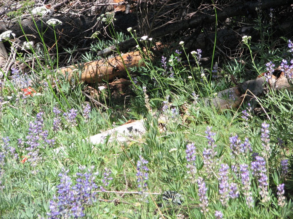 The alpine flowers of Washington can be stunning. This has been a good year, at least in the early part of the summer.
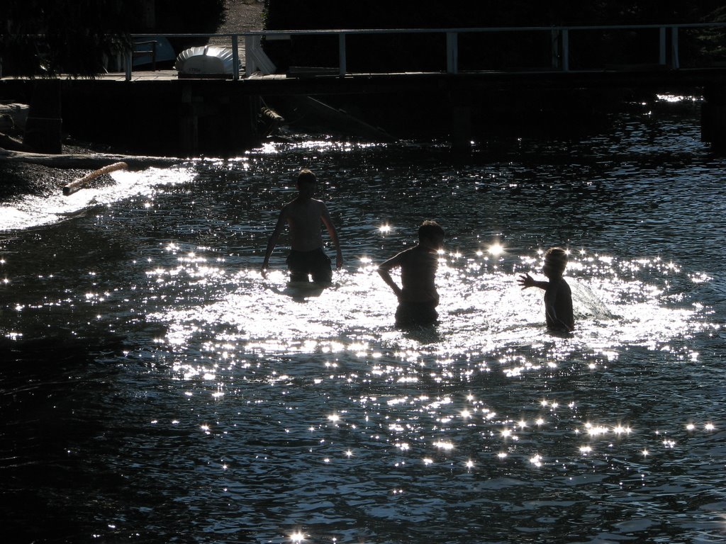 It seems to have Beach Week over at the London Daily Photo and at the Paris Daily Photo, so here's my contribution: fun in the summer sun. These three boys are preparing for a water-balloon fight in celebration of a 12th birthday. I can't imagine what sort of strategy they were cooking up, but they were intently debating the options and the merits. I would have thought that a water-balloon fight would lose its charm were I standing waist-deep in the ocean, but I'm no longer twelve.
 I am stunned at the enormous roads they build in Texas. This intersection on the south side of Austin is an incredible spray of concrete. It's quite impressive, but one really has to wonder if this scale of road-building is necessary. I'm not going to defend the brilliant engineering of the local folks, but they clearly like things big in Texas.
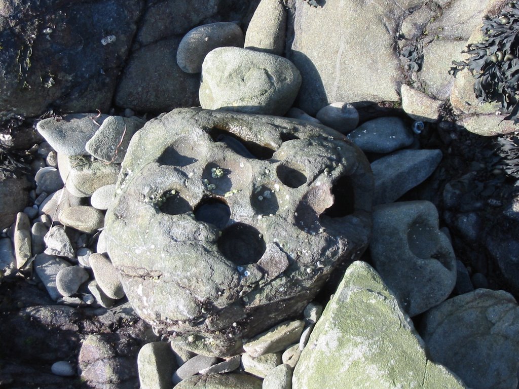 A rolling rock gathers... dimples?
I can't figure out where all these dimpled rocks come from. This photo is from the Pacific coast on the shores of Washington (state). Look up Cape Alava, WA in Google Maps. These rocks are pounded and rolled by the tides of the Pacific. Cape Alava is exposed to storms throughout the year, so the rocks become round. But many of them have these large dimples. The dimples are golf ball-sized and a few inches deep. What causes them?????
 I was looking out my office window at a gray day in April (3-apr-2006) and I decided to use the only camera at-hand to take a photo: my camera-phone. It proudly presents itself as a 1.3 megapixel, but it's not really a camera. Snapshots, maybe, but not photographs. However, interesting things come when you're least expecting them, rather like those cheap Russian (?) cameras that people use to take creative photos. They're not accurate, but the distortion is interesting and can be artistic. So here's my entry. I had to straighten out the horizon and crop the photo down a touch, but that sort of solarization going on here - that's all in the camera.
 Lions, acutally. These are the Vancouver (BC) lions in profile. Stanley Park is the beautiful park in the heart of Vancouver. From the north end of Stanley Park, the Lions Gate Bridge launches across the mouth of Vancouver Harbor to North Vancouver. The bridge is named for the crouching lions seen in the northern distance. See if you can find the lions here.
 On a clear day, Mount Olympus reigns over the northern suburbs of Seattle. The fog is rising but the mountains loom above, illuminated by the rising sun. The Olympic mountain range covers the northwest corner of Washington state, deflecting and blocking the worst of the Pacific weather. The surviving moisture drizzles the Puget Sound basin in the winter, giving Seattle its reputation, but the bulk of the moisture creates the great temperate rainforest that shares the Olympic name and covers the western flanks. The advancing summer season struggles with the winter snows but have not yet won the high ground, and the rivers are swollen with the casualties of warmth. It is early in the morning as the sun has not yet illuminated the nearby houses and hills.
 There is a lot of construction proceeding in Kirkland, WA. This hole is to be a new hotel. I find it to be an enormously impressive hole (foundation) for a 2-3 story hotel. If you look carefully, you may be able to recognize the forms of the floor of an underground parking garage. The light blue coils are evidently cables that will be under tension, embedded in the concrete. Against the far wall, you can see the reinforcing structures that help hold the walls of the hole in place during construction. I assume that these will be removed as the building / parking structure / foundation completes.
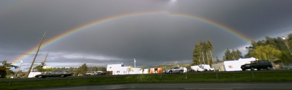 That rainbow really struck me. Certainly, I've seen rainbows, but this one was unusually intense in color and nearly complete. It wasn't a full circle, but I usually think of rainbows as fading off on one side. After I resumed driving, I kept peeking at the rainbow and it started to fade. I was lucky to see it full and intense for the brief time it was there.
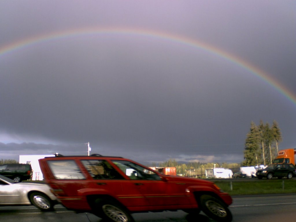 Our Spring weather has been unsettled and unusually violent for this area, bringing hailstorms, rainbows, and drenching rain. I was stunned by a fabulous rainbow as I was driving south of Seattle the other day, so I whipped out my cell-phone and took a picture of it. Don't be alarmed - I had pulled to the side of the road to stop and safely take the picture. It is rather interesting that a passing car gets skewed; there must be some sort of sequential scanning process in the camera exposure.
 Hiking along the Pacific beach near Cape Alava, WA, we came across this striking display: a bleached clump of trees above a candy-striped log.
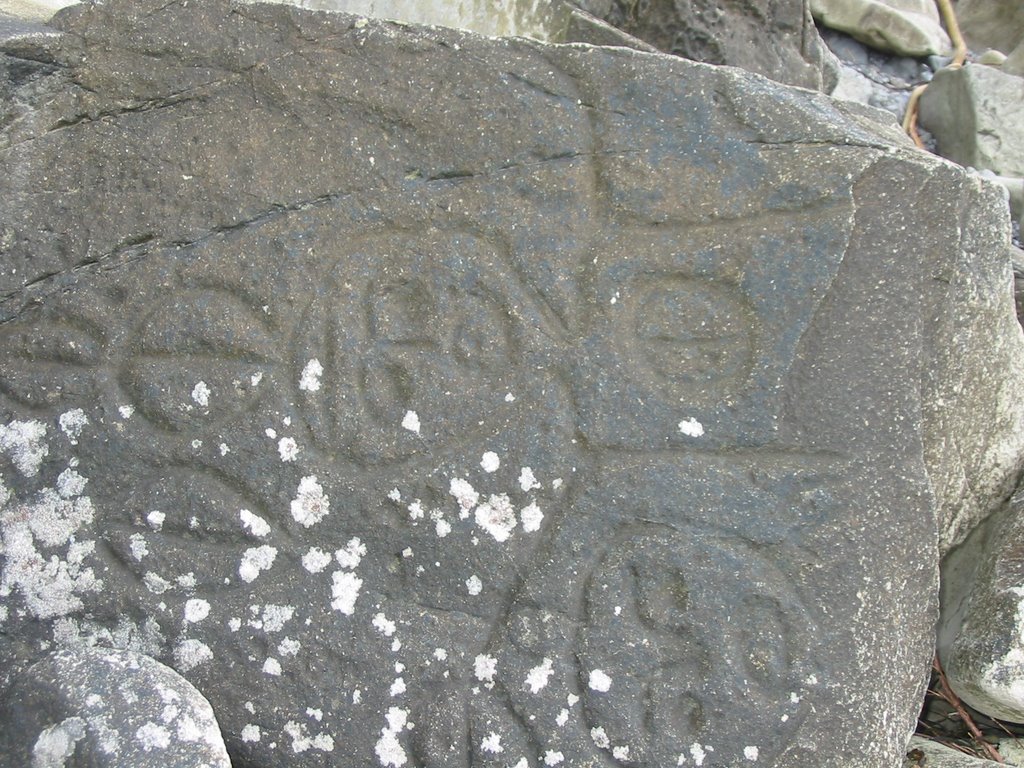 We went on a backpacking trip in the Olympic National Park. Most people think of mountains and snow in the Olympics (surrounding Mt. Olympus) but an unexpected part of the park is the rainforest and coast. These petroglyphs are south of Cape Alava, the westernmost part of the continential United States (traditional). There is a clump of rocks that cut the beach to the sea and have the name Wedding Rocks. I don't really recall, but I think the photo is in the "correct" orientation, though the rocks have probably moved since the original creation of the petroglyphs. There are a many other petroglyphs among the rocks, but I think people are starting to add modern ones. These seem to be authentic and old (1000 years, perhaps?).
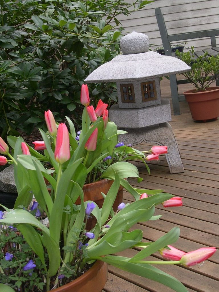 Spring in Seattle comes early and lingers. We have our soggy days, but the sunny ones make up for the rest. Our tulips come out and last. I grew up in the Midwest of the U.S. and the tulips lasted for a day or two. In Seattle, we get weeks and weeks of pleasure.
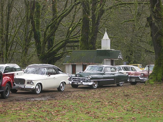 We were out on a drive to see the eagles on the Skagit River. During the winter months, the eagles follow various salmon runs, and the Skagit seems to be one of the favorites; it also happens to have a road that allows easy access - Route 20, the North Cascades Highway. Our tour started near Concrete, WA, and continued east, including stops at Rockport State Park and Mile 100 (a wide spot in the road). Along the way we happened across a tour group of restored cars. As the drivers lunched nearby, the cars formed an impromptu show.
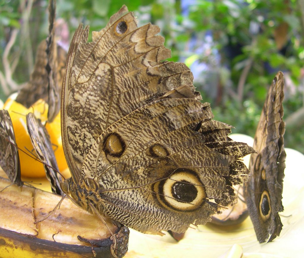 The Seattle Science Center has a tropical butterfly house. Inside it's hot, humid, and bright. The visitors walk paths among tropical plants, gawking at the flowers and the butterflies. The butterflies congregate around flowers, water, and plates of food. This particular butterfly must be approaching the end of his life. His neighbors have smoothly undulating edges to their wings, but this one is tattered. He seems to be enjoying a banana.
 We were using our snowshoes on Mount Rainier, WA. We parked by Paradise Visitor Center and started climbing. The day started out clear but clouds came in during the early afternoon. At times we were climbing through overcast and snow, but there was also plenty of sunshine. This image captures a period of change.
 I've been visiting daily a couple of photoblogs. The first one I found was the London Daily Photo (LDP). The LDP was inspired by and introduced me to the Paris Daily Photo (PDP). These are wonderful. In honor of the first anniversary of the PDP, I offer this little snapshot of an obscure part of Paris with a wonderful name, Rue du chat qui peche. My poor abilities in French give this street the name "Avenue of the Fishing Cat".
Eric, the host of PDP, has a special listing of photos he has received in honor of his first anniversary, and I encourage you to have a look!
 A simple sand pendulum can create complex, interesting figures as the point swings through the sand - Lissajous figures. These sand pendulums are often sold in little shops. One of the shops in Port Townsend, not far from Seattle, happened to have their pendulum swinging at the moment of the 2001 Seattle earthquake, and this image is left to us to ponder. The owner named it The Earthquake Rose.
 Seattle is on the Ring of Fire, a massive curve around northern part the Pacific Ocean. As the tectonic plates move, we develop neighbors who like to party. Five years ago, 28 February 2001, Seattle had a reminder of our party-hardy neighbors: an earthquake. Everybody has their story to tell and everyone remembers exactly where they were when "it" happened.
  The Northwest Flower and Garden Show comes to Seattle like a tropical breeze each February. The floors of the Convention Center blossom with displays and booths. This display was an interesting combination of flowers and glass in the style of Dale Chihuly.
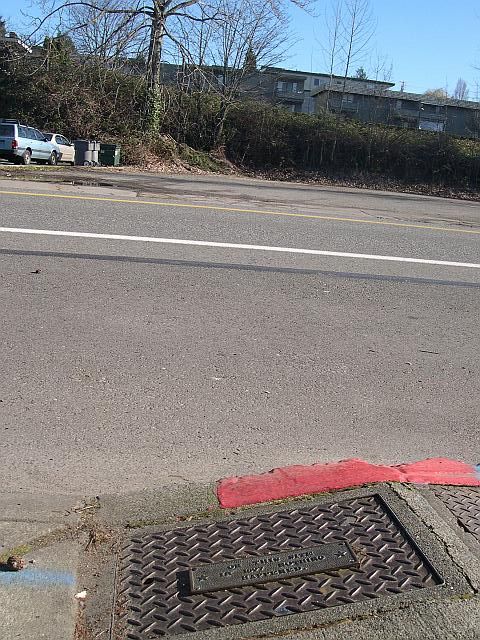
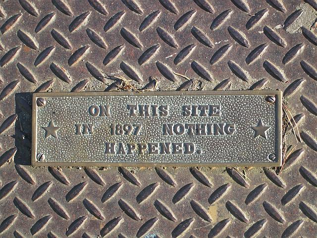 The plaque reads as it says. Kirkland, WA.
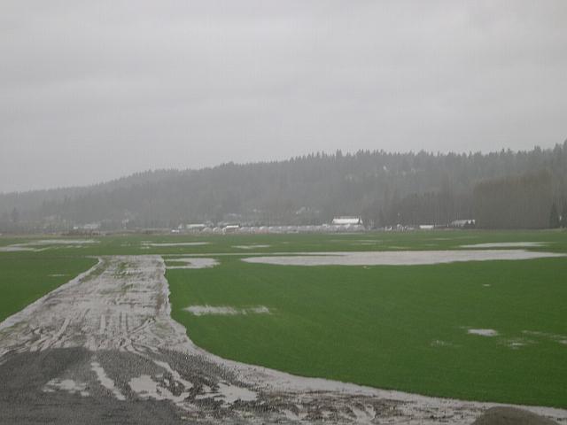 What do you do with a valley floor that is also a floodplain? You might build houses or businesses there, but they would flood regularly. Here's a clever idea: build a sod farm. Yep, grow grass. Then when the fields flood, you don't lose much. If the floods recede quickly enough, you don't even lose the grass - it will recover quickly.
 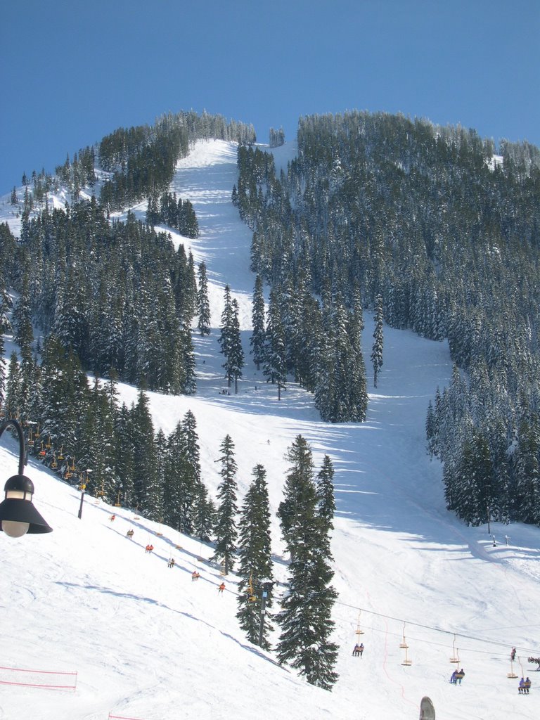 The good side of all that rain is: snow in the mountains. We went skiing at the Stevens Pass Ski Area on the afternoon of a recent football game. It was great. The day was sunny, as you can see to the right, the crowds were light, the snow was good, and the lift lines were brief. There was even plenty of seating and eating room (normally it's a struggle to find a place to sit).
 It is raining again in Seattle. After a day of brief relief - it takes just one to interrupt the record string - we're back into rain. Two and a half times the average amount of rain for January and an inch short of the wettest January on record. Water is everywhere. The rivers had started to drop, but they're higher than ever. Hillsides are slumping; one stretch of a hill slid into the Oso River and blocked it. The emergency folks brought in construction equipment to dig a new river channel to save nearby houses.
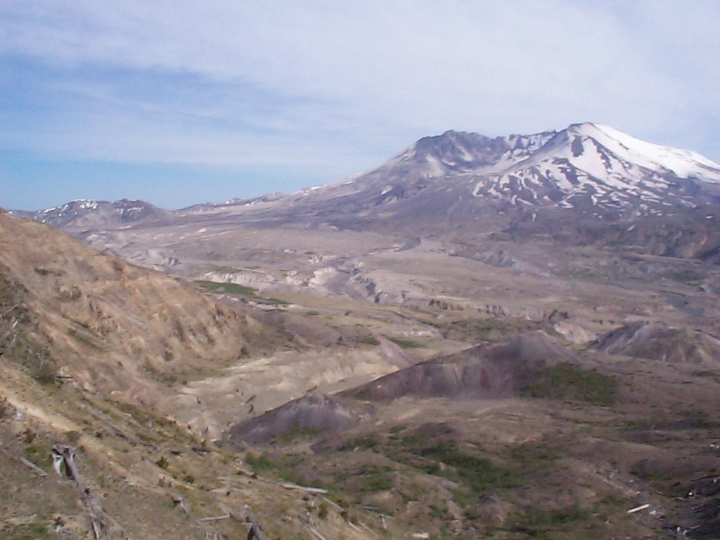
 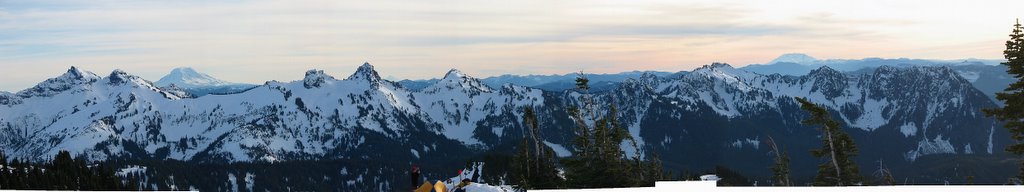 We've had another sunny day, but don't tell anyone - they might think there's a pattern here. But the sunny day calls for another mountain photo. This panorama is from the slopes of Mt. Rainier and looks roughly south. The tall volcano in the distance on the left is Mt. Adams; the volcano hiding in the center distance is Mt. Hood, and the volcano on the right is Mt. St. Helens.
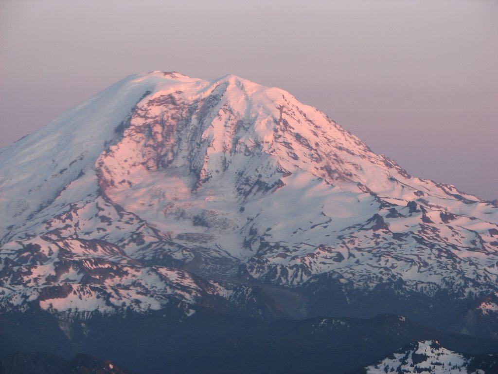
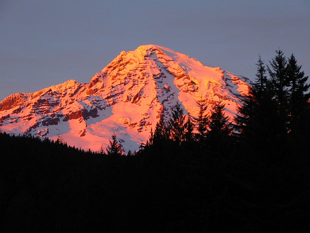 The rains have broken and I saw Mt. Rainier for the first time this year. It feels like a long time since Mt. Rainier was last visible; those layers and layers of clouds can weight more than one might think.
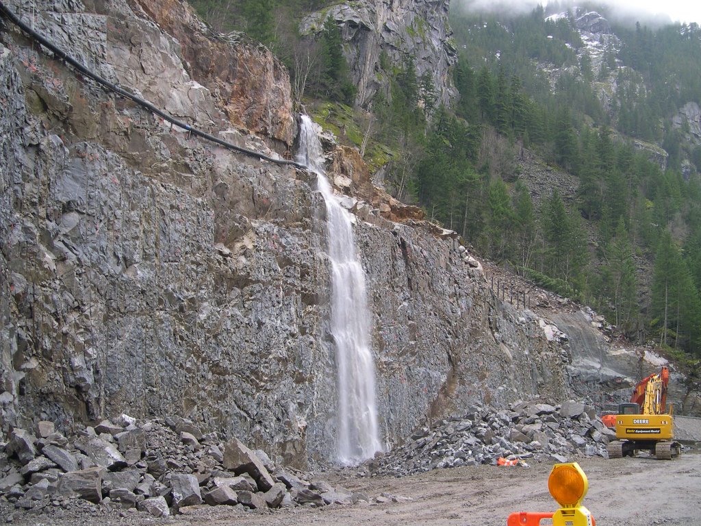 We went out looking for eagles today. At this time of year, bald eagles commonly come south from Alaska to roost along salmon rivers in the northwest of the US. We were looking along the Skagit River north of Seattle. This is an area where the road had previously washed out and there is a (locally) massive reconstruction project. The face of raw rock in the photo indicates the scale of the construction (see the "little" excavator in the lower-right corner). Further up to the hill one can see a valley in the mountain side that channels water into a stream. As the construction shows, the stream is powerful enough to undermine and wash out the road.
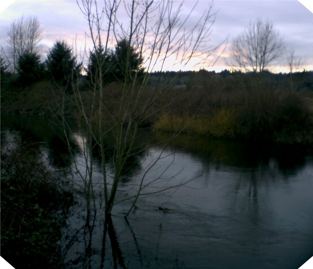 It's not that bad. The rains continue and the rivers are in flood, but the floods are pretty normal for this time of year. This picture shows a slough, a channelized flow that leads from the north end of Lake Sammamish in Redmond to the north end of Lake Washington in Kenmore. As you might tell from the sapling in the foreground, the slough flow is normally lower - about 1.3 meters (4 feet) lower, in fact. This picture was taken where NE 124th street crosses the slough, looking southwest (the glare in the distance is the setting sun around 4:30pm or so).
  Seattle is a rainy climate in the Winter, there's no denying it. We get a lot of rain. To be more precise, we get a normal amount of rain and it takes a long, long time to fall. Our typical rainy day is 4-8 mm (less than 1/4-inch) as measured in my backyard. Over a year, that's roughly 40 inches (102 cm). We call it our "liquid sunshine" and instead of "showers", we note the exceptions as "sun breaks".
 We went on a hike today to see the Big Four Ice Caves, about an hour away from our home. We piled two kids, four sets of snowshoes, lunches, poles, hiking gear, and winter clothing into the car and headed off. I cleverly grabbed a spare battery for my camera. We arrived, unpacked and dressed, but the snow depth was insufficient for snowshoes and we only needed hiking boots. We got to the trailhead and there was a nice view of the clouds parting over Big Four Mountain. I whipped out the camera, turned it on, and viewed the message "No Memory Card". No problem! I reached for the spare memory card that I keep in the camera bag. No Memory Card. The spares were sitting on my desk - at home. Fortunately, my new cell phone comes with a little megabit camera, so I gave that a try. Herewith is the result.
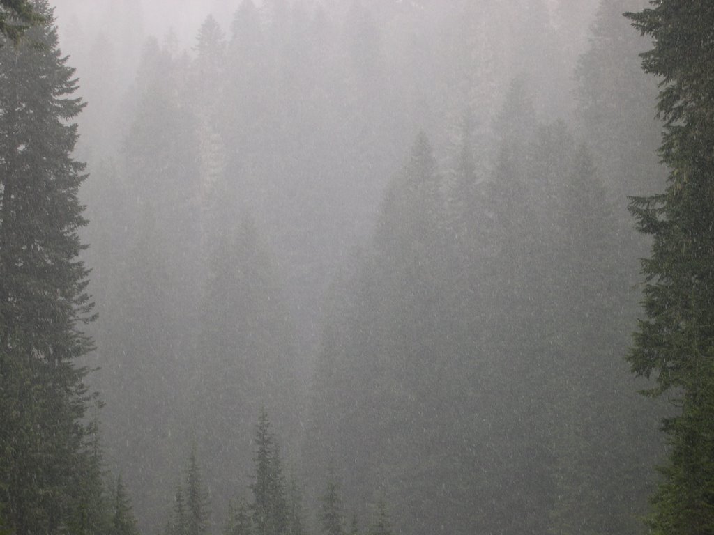 Twenty-five days of rain. We have had 25 consecutive days of rain in the metropolitan Seattle area and we're heading toward the record of 33 days of rain. It will come as a surprise to many that Seattle can think of this as unusual. "It's the rainy city, the Emerald City," I hear you cry, "how can they call any amount 'too much rain'?" Well, even we have our limits! For those keeping track at home, the record for Spokane is more like 50 consecutive days.
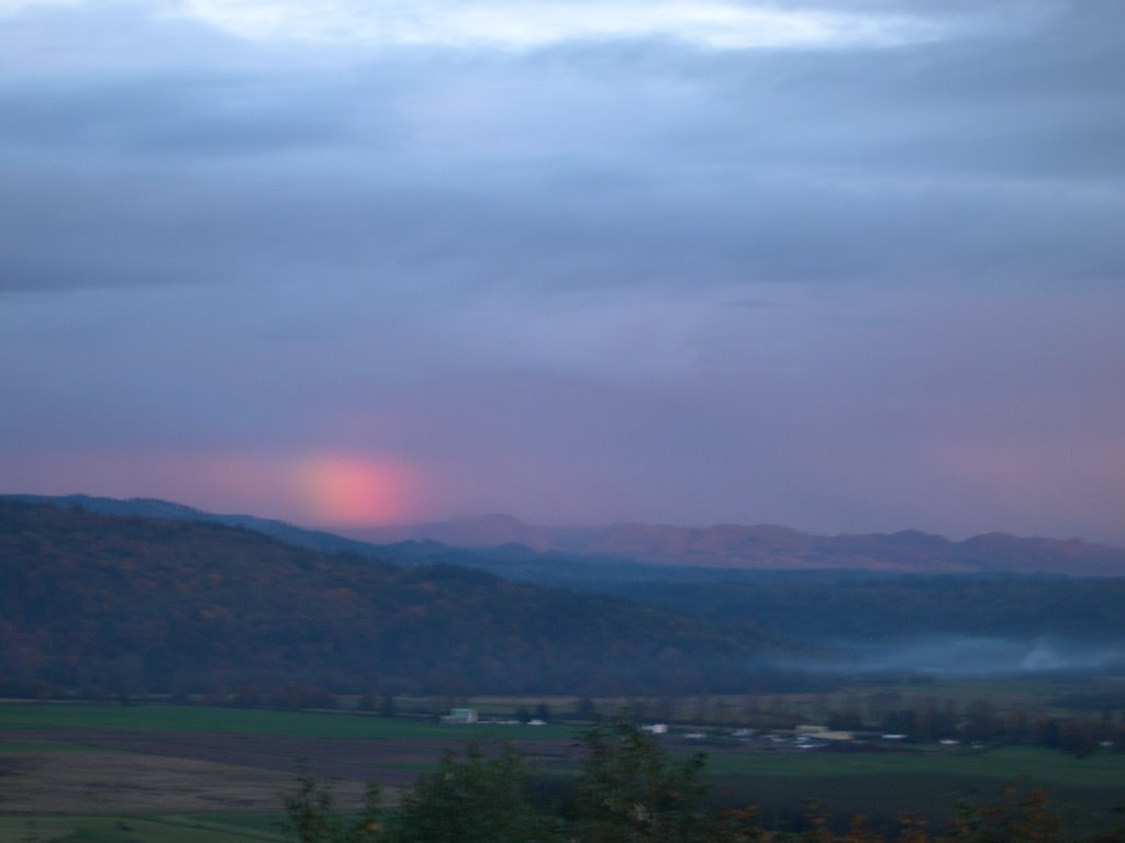 Here's a smudge of a rainbow, an abbreviation. I'm on a ridge overlooking a river valley with the sun setting behind me at the end of a rainy day. Somehow, physics shows me a fragment of a rainbow in the settling darkness.

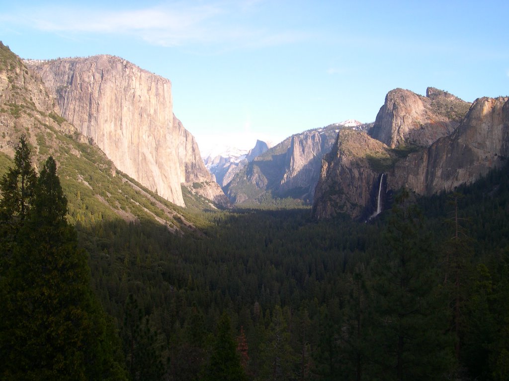 This is the Yosemite Valley (California) on the afternoon of December 24th, 2005. This panorama has shown itself millions of times since the glaciers retreated from California.